
Much of my MFA work focussed on considering and exploring notions of space and place. Of finding ways to articulate spaces of the everyday that operate as thresholds and/or places of transition; where land meets water, such as ports, as well as other points of departure, such as bus and train terminals. These places I walked around, attempting to know in an embodied way, and considered them as environments of non-place and of placelessness, referencing the work of authors such as Marc Auge, Edward Relph and Michel de Certeau.Since then I have continued to think about space, specifically urban spaces, and how we know them. Thinking about cities, about how we engage with them, perceive them and know them. In my Masters work I considered maps as knowing devices both useful and problematic. Stretches of road marked with alternate names at each end, some transition implied but where?Throughout this project I have been thinking of cities in other parts of the world. My mentor Gabi is based in Berlin so our conversations negotiate both distance and time, and has further influenced my thinking. It seems so strange to build a relationship with someone on the other side of the world- spaces and places who have no understanding of. There’s a certain familiarity felt for many cities around the world- even those we may not have been to. History, the media, discourses in all fields contribute to our perceptions of place in ways useful and misleading. Monuments stand, as Richard Sennett suggests, as exclamation points within cities, and who doesn’t know the Eiffel Tower? Maps help us negotiate these urban spaces, locating such monuments and grounding us in the geography of space. But no map, either digital nor in print, can convey the true scale of a city. No matter how sprawling upon the various fold out sections, or how often we return to the scale- 1:5000, 1:10000, etc; there is, to me at least, a meaninglessness to such numbers and the representations they refer to. Everything about the map refuses the embodied experience of negotiating the city on foot. Topographic maps enable some sense of the landscape we would find ourselves in; contour lines indicating gradient, indications of vegetation. But urban maps largely fail in attempts to convey the undulations and specifics of the city, which remains flattened and inert. The built environment is non existent while street names clutter the page. The negotiation of space is optic, not haptic, perceived but not experienced.So what to do with a map… Could a map be more? Perhaps a map could embody. Perhaps one could embody a map…
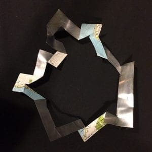
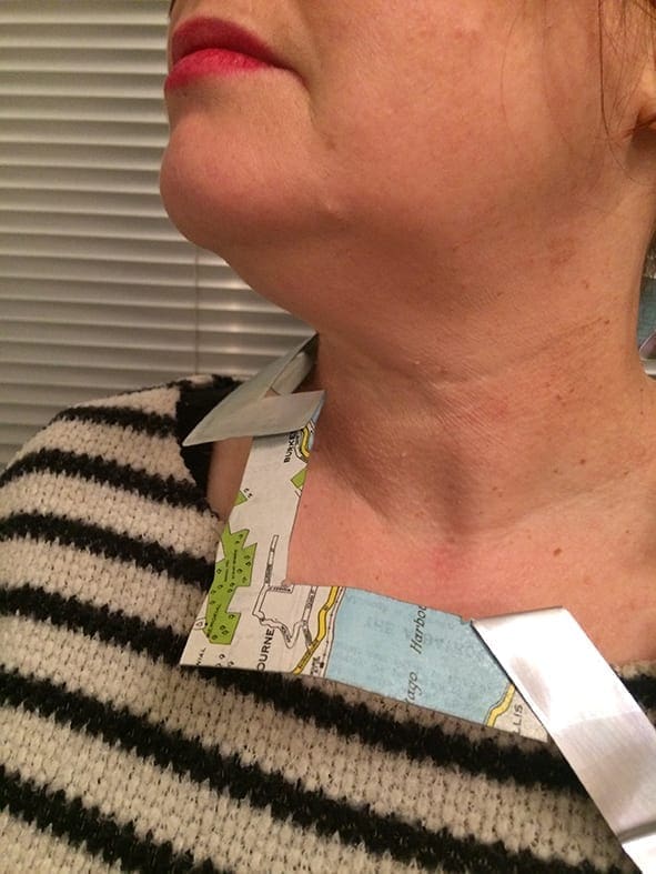
Dunedin Map Necklace #1 (2020). Aluminum and Paper
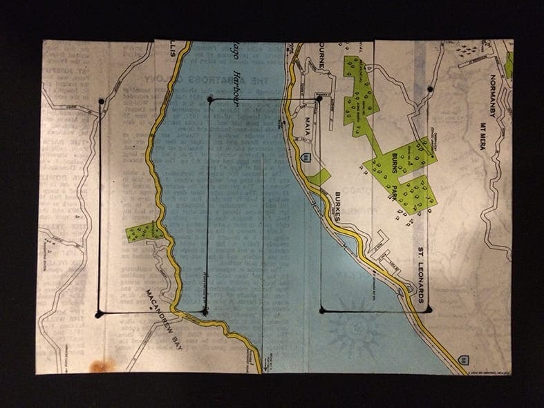
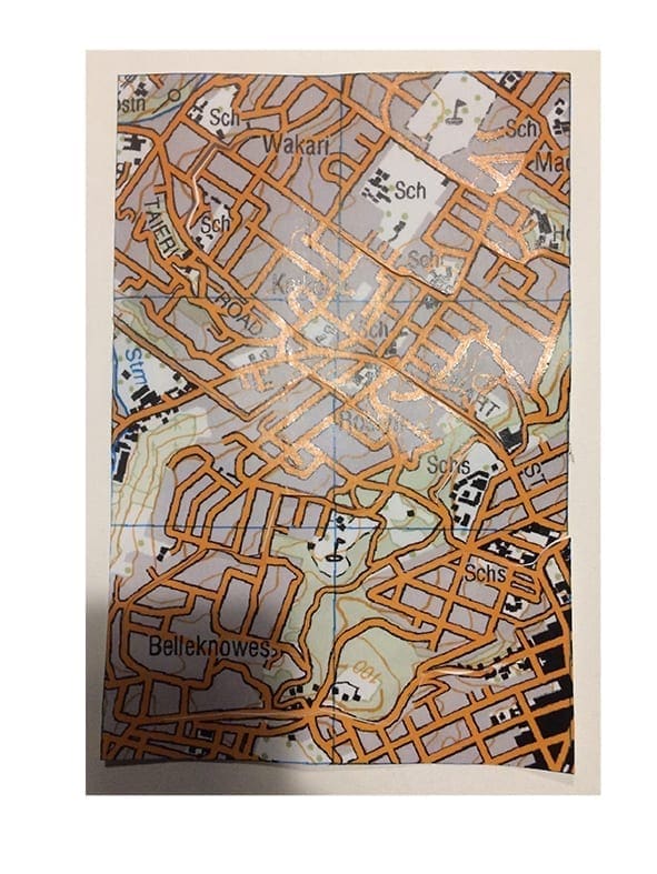
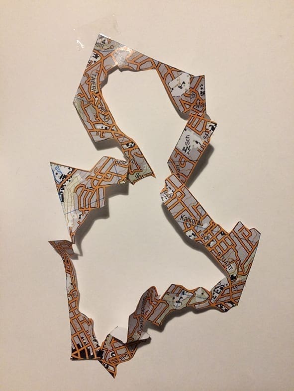
Dunedin Map Necklace #1 (2020) Aluminum and Paper Map
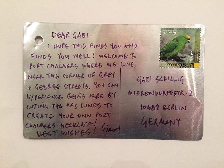
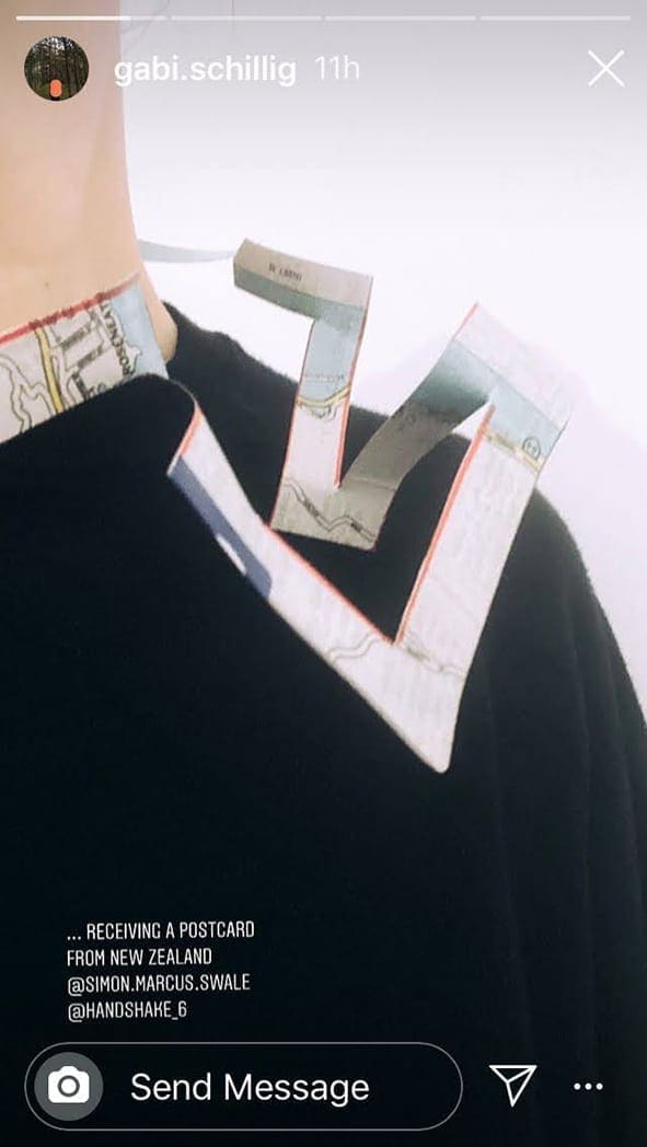
I began by cutting paper, inspired by a workshop with Peter Bauhuis where we had to cut a hole in a postcard size piece of paper that you could then put your head through. I then applied the same process to photocopied and printed out maps. Gabi and i have been talking about communication across our geographical distance, wondering for instance how long it would take to send a letter these days. So i had resolved to send a letter and thought maybe i could include a map necklace also, something she would have to cut out and make herself, maybe a map of Dunedin that would connect here closer to the place the letter (and I) come from?Wanting to make the necklaces more durable, I stumbled upon old lithographic printing plates and began bounding the maps to these- aluminium thin enough to cut with scissors. Now i could make a postcard-map-necklace; i didn’t need to put the necklace in an envelope, i could send it directly! So i sent one to Gabi and a couple of weeks later she posted her new necklace on Instagram 🙂
Dunedin Map Necklace #2 (2020). Aluminum and Paper
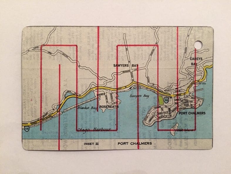
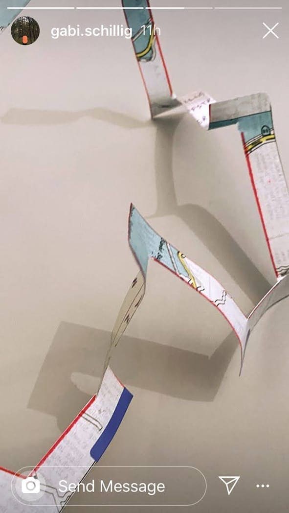
.I’m really enjoying the potential of these new pieces. Once cut they must be opened out, stretched and folded to become wearable. The necklace itself becomes a landscape to be worn upon the body, some new manifestation of the geography of the map. The aluminium provides structure, stability, but also flexibility. It is soft and light, flexing as the body moves through space. Initial cutting plans were purely functional- the way to cut the rectangle into a wearable form. More recent versions have better utilised the graphic marking of the map itself to guide one’s cutting. There is freedom to explore and consider the map ( and the space it represents!) more extensively. One might use the map as a real world guide, cutting the path you follow- or follow where you cut.Maps offer a particular view of the world, a system of knowledge deemed rational and scientific. But maps are problematic, disingenuous even- sly representations that obscure and hide alternative realities. Subjectivities denied in the name of objectivity… there’s something here that i can see unfolding…
Dunedin Map Necklace (Test) (2020). Paper